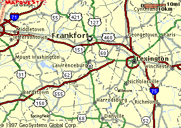
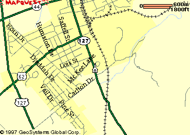
Follow US 127 South to Lawrenceburg. At the intersection of US 62 (Corner with
Wal-Mart, the High School, and The Food Court) turn Left. Follow US 62 to Main
Street (T intersection) and turn Right. The building is on the right at Franklin
Street.
From Lexington
Follow signs to the Bluegrass Parkway. Travel West on the Bluegrass Parkway and
exit at the Lawrenceburg exit. Turn Left from the ramp onto US 127. At the
bottom of the hill turn Right onto Old US 127 (there is a car dealer on the
corner). Follow Old US 127 about 5 miles until you pass under a railroad
overpass and start up a hill. The building is at the top of that hill on the
left at Franklin Street.
From Downtown
Travel South on Main Street and pass Broadway. The building will be on the right
at Franklin Street.
From US 127
Travel North or South on US 127 toward US 62. This is the corner with Wal-Mart,
the High School, and the Food Court. Turn East on US 62 and follow this to Main
Street. (T intersection) Turn Right onto Main Street and the building will be on
the right at Franklin Street.
Maps provided by
Mapquest
Please send comments, suggestions, or questions about this page
to Rocky Russell (rockyr@qx.net)
This page last updated on May 3, 2001